Here are some links to pictures we've taken in the past 2 weeks. Just seems like I can't get "in the groove" to actually post, so thought I would play "Catch Up" with pictures and then tell you about our trip to Mt. St. Helens yesterday. So here are the links to pictures. Just click on the picture and the album will open in My Web Albums in Picasa.
The story of the Mount St. Helens eruption on May 18, 1980 is very powerful. The first earthquakes that signalled that the volcano was awakening occured in late March, 1980. As the frequency and intensity of the earthquakes increased the Forest Service and geologists were on alert and monitoring the volcano. Along with the earthquakes, which occurred about one to two miles beneath the north slope of Mount St. Helens, a large bulge was growing upward and outward on the north face of the cone. The bulge was more than a mile in diameter and pushed out 300 feet by mid-April. It was growing at a rate of five feet per day.
The Forest Service had set up a Red Zone around the mountain and had evacuated people from the area. On Saturday, May 17 some people were let back in to retrieve belongings from their homes and there were plans to let another group of people in on Sunday, May 18th. Dave Johnston, a geologist monitoring the volcano from a ridge 5.5 miles from the volcano, made an early morning radio report that the bulge continued swelling at a steady rate. An hour later Dave was dead. At 8:32 AM an earthquake of 5.1 magnitude shook Mount St. Helens and triggered a giant avalanche of the bulging north slope of the cone and slid away into Spirit Lake. The blast cloud shot out of the torn-open north face and quickly outraced the speeding avalanche. It raced north, northeast and northwest, climbing ridges and sweeping down valleys, killing everything in its path. It blew trees down like toothpicks and destroyed 230 square miles of forest. That took about 5 minutes.
The unroofed magma column jetted upward for the next nine hours into a fifteen-mile high ash cloud. More dense portions of the ash cloud near its base formed pyroclastic flows of hot rock fragments fluidized by expanding gas. These flows poured our of the horseshoe shaped crater toward Spirit Lake. Mudflows - floods of water from melting ice, the ground water soaked avalanche, and the water from Spirit Lake rushed down the stream and rivers. Homes and bridges were swept away. Much of the mud ended up in the Columbia River, clogging the navigation channel for months.
Fifty-seven people died and property damage totaled 1.5 billion dollars. One person we talked to said if it would have happened on Monday rather than Sunday, more lives would have been lost because many of the men would have been working at the logging camps.
Mother nature is doing her part to recover from this terrible event as are private and public entities. Weyerhaueser Lumber began an aggressive reforestation program and the Forest Service alone salvaged 200 million board feet of downed and standing dead trees and has replanted millions of small trees. Replanted areas are labeled with signs indicating the type of trees that were replanted and the year replanting occurred. And most amazing of all, after five years, the numbers of Roosevelt elk and black tailed deer at Mount St. Helens were back to normal.
Inside the National Monument boundaries, which include Mount St. Helens, 110,000 acres have been set aside to study Nature's process of healing itself. No replanting was done in this area, so it is still very stark with patches of renewal. Researchers from around the world are studying this area and learning about the recovery of a totally destroyed ecosystem.
Geologists continue to monitor Mount St. Helens with sophisticated equipment hoping to be better able to predict her next eruption.
The Mount St. Helens Visitor Center, at the beginning of the drive; the Forest Learning Center, and the Johnston Ridge Observatory all depict different aspects of the eruption. Each has wonderful displays and short movies which really help the visitor understand all the events that occurred on May 18, 1980.
This drive to Mount St. Helens was, for me, both very sobering and exciting. Sobering, as I saw up close what can happen in just a very few minutes when something this catastrophic takes place; but exciting to see the beautiful new trees, many of which are now 25 years old, the bright patches of color from the brightly colored flowers and the Roosevelt elk that I watched along the river from the Forest Learning Center overlook. It was also refreshing to see how the people have recovered and rebuilt as we drove along Route 504 which follows the North Fork of the Toutle River, leading to Johnston Ridge Observatory. Much of the original road was buried beneath the avalanche and mudflows of the 1980 eruption. The new road was built during 1992-1995.
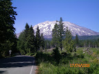
We were able to see the mountain from Elk Rock lookout, but because of thick cloud cover, we could not see it from Johnston Ridge Observatory. There is a cloudy picture in the web album, and here is an "official" picture from the Mount St. Helens website.
Not sure what we doing Thursday. We may check out the south side of the mountain which was unaffected by the eruption or we may drive to the Pacific Ocean. Dan and Erin are probably getting tired of trees and more trees, so the Ocean may be a good choice. Will decide in the morning.
Happy 17th Birthday, Taylor
More later....










 Posts
Posts

